
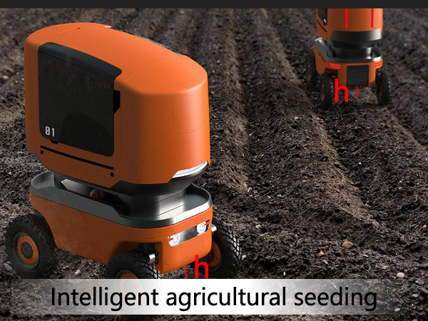
Intelligent Agricultural Seeding System Raspberry Pi Lidar Module
In the intelligent agricultural seeding system, the Raspberry Pi lidar module plays a crucial role in tasks such as obstacle detection, terrain mapping, and precise seeding positioning. Here’s an introduction about laser range sensor module:
Applications
1. Obstacle Detection: In an intelligent agricultural seeding robot, the lidar module is installed on the front of the robot. It works with the Raspberry Pi to detect obstacles in front of the seeding machine in real-time, enabling the robot to plan collision – avoidance routes and ensure the smooth progress of the seeding operation.
2. Terrain Mapping: The lidar sensor can scan the terrain of the farmland to obtain elevation data of the ground. The Raspberry Pi processes this data to generate a terrain map, which helps the seeding system adjust the seeding depth and sowing density according to different terrain conditions, ensuring uniform seeding.
3. Precise Positioning: By scanning fixed markers or the surrounding environment in the farmland, the raspberry pi lidar module can provide accurate position information for the seeding equipment. Combined with the navigation system, it enables precise seeding at the set positions, improving the accuracy of seeding and reducing problems such as missed or repeated seeding.
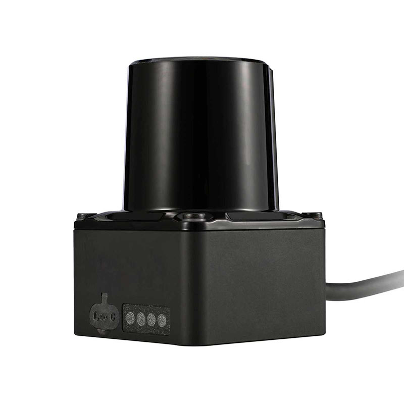
Typical Lidar Module
1. Seakeda LS-T3: This is a commonly used lidar module that can be easily connected to the Raspberry Pi. It has a measurement range of 10m, a scanning angle of 270°, and a measurement accuracy of ±2cm. The data interface is a USB port, and it is powered by USB. In the Raspberry Pi environment, by installing the corresponding ROS driver package, the data collection and processing of the lidar can be realized.
2. PTWC-H05X: The laser distance module also has good compatibility with the Raspberry Pi. It has a measurement range of 0.03 – 50m, frequency of 500HZ, and a measurement accuracy of ±3cm.
Hardware Connection
Usually, the lidar scanner is connected to the Raspberry Pi through a USB cable, so that the Raspberry Pi can receive the point cloud data transmitted by the lidar.
Software Configuration
First, install the operating system suitable for the Raspberry Pi, such as Raspbian.
Then, install the ROS (Robot Operating System) environment. Take the LS-T3 lidar sensor as an example, create a ROS workspace, compile it, and add the relevant environment variables.
After the configuration is completed, the lidar data can be read through the Raspberry Pi and further processed and analyzed.
In intelligent agricultural seeding systems, Raspberry Pi-compatible lidar modules are mainly divided into 2D scanning and single-point ranging types. These laser distance modules meet diverse needs such as farmland obstacle detection, terrain mapping, and precise seeding positioning.
Post time: Dec-02-2025


